How Planetary Scientists Study the Surface of Mars
Planetary scientists map the Martian surface using a combination of remote sensing, orbital imagery, and direct exploration to uncover the planet's history and potential for past life.
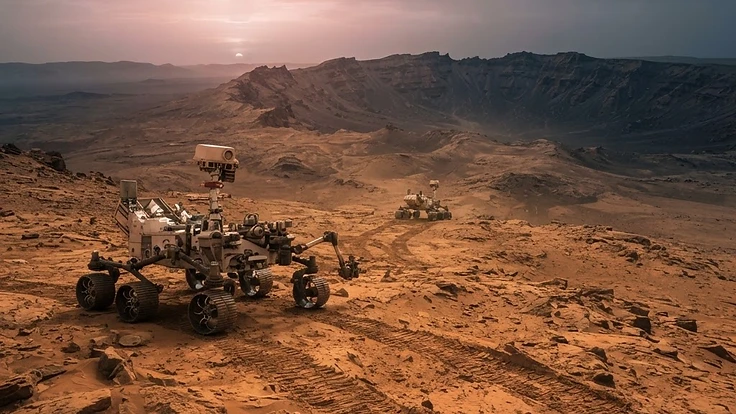
Planetary Scientists Map the Martian Surface
Studying the surface of Mars requires a unique blend of orbital mechanics, advanced imaging, and robotic engineering. Scientists seek to understand the geological evolution of the planet by analysing its diverse landscapes, from massive volcanic shields to expansive canyon systems.
This research informs our understanding of how terrestrial planets evolve over time. By looking at the scars left on the Martian surface, researchers reconstruct the ancient climate and identify areas that may have once hosted liquid water.
The Science Behind It
Scientists rely heavily on remote sensing to gather data from millions of kilometres away. Orbiters equipped with high resolution cameras capture detailed terrain models, while spectrometers reveal the mineralogical composition of the soil and rock layers.
Techniques such as photogrammetry allow researchers to build three dimensional maps from two dimensional images. This is similar to how we measure the depth and scale of a near-Earth asteroid approach. By cross referencing these images with seismic data, scientists can determine the thickness of the Martian crust.
Direct sampling provides a crucial ground truth for these orbital observations. Robotic rovers drive across the surface, using drills to collect core samples that are then analysed by onboard laboratories. This helps clarify the findings presented in research like the nature and composition of intergalactic space.
Real-World Implications
Developing the technology to survive and work on the Martian surface has immediate benefits here on Earth. Advances in autonomous navigation, power management, and material science for harsh environments find their way into everyday tech.
Monitoring these distant worlds also provides perspective on our own vulnerabilities to space weather and cosmic hazards. Understanding how Mars lost its atmosphere helps us model the protective role of Earth's magnetic field, a topic explored in how planetary science reveals Earth's vulnerability.
Infrastructure designers and satellite operators benefit from the materials research conducted for Mars missions. Understanding extreme radiation environments drives innovation in shielding, which ensures our own communications networks remain stable during high solar activity.
What You Can Do
You do not need to be an astrophysicist to engage with planetary science. Publicly available solar imagery and mission archives allow anyone to follow the latest discoveries in real time. Accessing a comprehensive glossary can help you decode the technical jargon found in mission updates.
If you are interested in the solar processes that impact our own planet, you can monitor live conditions using our interactive dashboard. Seeing how we track events helps contextualise the challenges faced by explorers in space. You can also monitor past events using the archive to see how solar cycles influence our neighbourhood.
Key Takeaways
Planetary science turns the Martian surface into a laboratory that reveals the secrets of the solar system. Through a combination of orbital perspective and ground based exploration, we build a complete picture of the red planet.
These efforts improve our technical capability while providing vital insights into the history of our own home world. By keeping track of the data, you remain informed about the ongoing discoveries that shape our future in space.
People Also Ask
How do rovers communicate with Earth?+
Rovers send data to orbiters circling Mars, which act as relay stations. These orbiters transmit the signal across deep space to the Deep Space Network on Earth using large high-gain antennas. The distance causes a significant time delay, typically ranging from 3 to 22 minutes depending on planetary alignment.
Can we see Martian features from Earth?+
While ground-based telescopes can see general light and dark patterns on Mars, they lack the resolution to see fine surface details like individual rovers or small craters. Only high-powered orbital telescopes or spacecraft orbiting Mars can provide the level of detail required for scientific mapping and analysis.
Why is mapping Mars important?+
Mapping is essential for mission safety, allowing scientists to select landing sites free of hazards like steep slopes or large boulders. It also helps researchers identify geological formations, water-carved channels, and mineral deposits that indicate whether the planet could have supported ancient microbial life in its distant past.
Continue Reading
Forecast These Questions
View all →Express your probability on these active forecast questions.