The Strategic Expansion of Human Activity in Cislunar Space
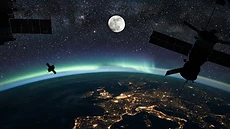
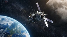
The region between Earth and the Moon is becoming crowded as global space agencies and private firms launch constellations to support telecommunications, navigation, and scientific research.
The Strategic Expansion of Human Activity in Cislunar Space
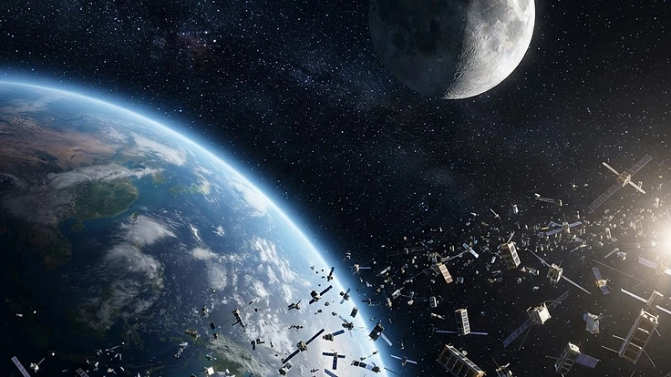
Human activity in space has shifted from a few isolated missions to a sustained, industrial presence. Cislunar space, defined as the region between Earth and the Moon, now hosts an increasing number of satellites and orbital platforms. This transition represents a fundamental change in how we use the space environment for modern infrastructure.
Commercial interest, combined with government ambitions, has accelerated the rate of launches targeting these orbits. We are witnessing the democratisation of space access, where once-exclusive domains are now populated by private constellations and scientific payloads. This expansion is essential for modern connectivity, though it brings significant new challenges for orbital management.
The Science Behind It
Satellites operate within the complex dynamics of the Earth and Moon gravitational fields. By placing assets in cislunar space, operators can maintain line of sight with both bodies, which is critical for relaying signals and coordinating deep space missions. This environment is physically demanding, requiring precise station keeping to account for the tug of gravity from multiple sources.
Technological miniaturisation has made this expansion possible. Smaller, more affordable components allow companies to launch arrays of satellites instead of massive, singular spacecraft. These platforms rely on solar power and advanced propulsion to navigate, how satellites monitor the ever changing space weather ensures their systems remain protected against energetic particles.
Navigating this region requires a deep understanding of solar cycles and geomagnetic activity. When particles from the sun accelerate, they can disrupt satellite electronics or alter drag coefficients in the upper atmosphere. Monitoring the Kp index is vital for operators who need to shield their hardware during periods of intense solar weather.
These assets also provide the infrastructure for research into [how aurora lights are formed]( /blog/how-aurora-lights-are-formed), helping us understand the connection between our planet and the sun.
Real-World Implications
The surge in satellite density directly impacts our terrestrial lives. High speed global communication, accurate time synchronisation for financial markets, and advanced weather modelling all depend on these orbital networks. When space becomes congested, the risk of interference increases, demanding better international coordination and standardisation.
We must also address the long term sustainability of these orbits. The orbital consequences of satellite collisions can trigger a cascade of debris that renders specific lanes unusable for decades. Active debris removal and improved traffic management are now primary concerns for [companies providing specialized space weather forecasting for businesses]( /blog/companies-providing-specialized-space-weather-forecasting-for-businesses) to protect critical infrastructure.
What You Can Do
Staying informed about the status of our orbital environment is easier than ever before. You can track current activity through resources that map live orbital paths and monitor environmental conditions. Using tools like the Flarient live dashboard helps you grasp the scale of current satellite constellations and the immediate risks posed by space weather events.
For those interested in the visual effects of our space environment, keeping an eye on local conditions is essential. If you are planning a trip to see the night sky, you might consider guided aurora tours in countries like Iceland, Norway, or Alaska to experience the beauty of solar interaction firsthand.
Always check your local aurora forecast to ensure your timing matches the peak visibility windows for your specific region.
You can also enhance your own awareness by adding embeddable widgets to your personal or professional website. These tools provide real time data feeds that translate complex solar metrics into clear, actionable information for any audience. Being an informed observer is the first step in supporting a safer, more sustainable approach to our expanding presence in the stars.
Key Takeaways
Cislunar space is no longer a void but a bustling, strategic domain. The influx of satellites has transformed how we communicate, navigate, and observe our environment from above. While this growth offers immense benefits for global technology, it requires us to prioritise sustainability and responsible orbital management.
As we look toward the future, our ability to monitor, track, and manage this space will determine the longevity of our technological capabilities. By leveraging accurate data and fostering international transparency, we ensure that space remains a viable frontier for generations to come. The era of cislunar development has truly arrived, and the responsibility of maintaining it belongs to us all.
People Also Ask
What is the Kármán line?+
The Kármán line is an internationally recognised boundary located 100 kilometres above Earth's mean sea level. It represents the altitude where the atmosphere becomes too thin to support aeronautical flight, effectively marking the conventional start of outer space for record-keeping and regulatory purposes.
How do satellites avoid colliding with each other?+
Satellite operators use sophisticated tracking systems and orbital telemetry to calculate precise trajectories. When a potential conjunction is detected, ground control teams execute manoeuvres using onboard propulsion systems to adjust the satellite's velocity and altitude, ensuring a safe distance is maintained between active assets and debris.
Why is the Dst index important for satellites?+
The Dst index measures the intensity of geomagnetic storms by monitoring horizontal disturbances in the Earth's magnetic field in units of nanoteslas. A lower Dst value indicates a stronger storm, which can induce currents in satellite electronics and lead to increased atmospheric drag, threatening hardware longevity.
Continue Reading
Forecast These Questions
View all →Express your probability on these active forecast questions.