Ionospheric Disturbances Pose Risks to Drone Operations
Solar activity can distort the upper atmosphere, potentially disrupting the delicate GPS signals that keep drones in the air and on course.
Ionospheric Disturbances Pose Risks to Drone Operations
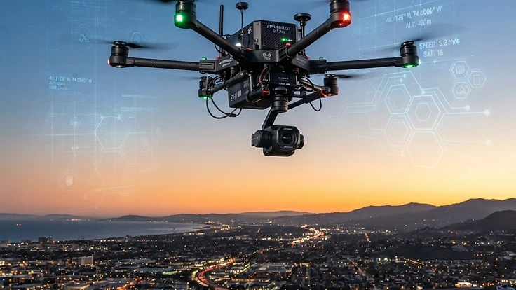
Modern drone operations rely heavily on the Global Navigation Satellite System for positioning and navigation. When the sun becomes active, it releases energy that reaches our atmosphere and can interfere with these signals, creating significant operational challenges for pilots.
Understanding how solar weather influences the ionosphere is vital for anyone who operates drones professionally. As we move through Solar Cycle 25, which began in December 2019, solar activity continues to trend upward, making the study of atmospheric interference increasingly relevant to aviation safety.
The Science Behind It
The ionosphere is a region of the upper atmosphere filled with charged particles that are created when solar radiation strips electrons from neutral atoms. This layer plays a crucial role in reflecting radio waves, but it also refracts the signals travelling from navigation satellites to the ground.
When a geomagnetic storm occurs, the density of these electrons fluctuates rapidly and unpredictably. These shifts delay the radio signals transmitted by satellites, which creates errors in the positioning data received by the drone flight controller.
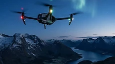
These disturbances often coincide with the appearance of an aurora at high latitudes, which serves as a visible indicator of intense energy dumping into the upper atmosphere. The NOAA SWPC tracks these events, often using the K-index to quantify the magnitude of the disturbance.
Real-World Implications
For a drone, an error of even a few metres in position can result in a loss of stability or a failure to maintain a pre-programmed flight path. While most commercial drones have internal sensors to mitigate minor inaccuracies, large-scale ionospheric turbulence can overwhelm these systems.
This is particularly dangerous during automated missions or flights that require high precision, such as site surveying or infrastructure inspection. If the link between the drone and the constellation of satellites is compromised, the drone may trigger a safety fail-safe, hovering in place or attempting an emergency return to its launch point.
Such interruptions often go unnoticed until the drone begins to behave erratically. Pilots who neglect to check space weather conditions before a flight face the risk of unexpected software overrides during critical flight phases.
What You Can Do
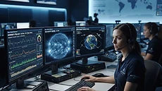
Preparation starts with monitoring the current state of the ionosphere before you take off. If you see high geomagnetic activity levels on a local aurora forecast or similar tools, you should consider postponing your flight until conditions stabilise.
Flarient provides embeddable widgets that allow you to bring this real-time data directly onto your own project sites or internal dashboards. Integrating these tools into your pre-flight checklist is a simple way to increase your situational awareness and ensure your equipment remains under control.
Beyond technical preparations, some enthusiasts choose to witness these events firsthand by joining guided aurora tours in regions like Iceland, Norway, or Canada to better understand the beauty and power of the auroral oval. Knowledge of solar physics often changes how pilots perceive the invisible forces acting upon their machines.
Key Takeaways
Ionospheric disturbances are not just abstract scientific concerns, they represent a tangible challenge to the reliability of drone guidance systems. Recognising that solar weather impacts satellite-dependent technology is the first step in effective risk management.
By leveraging existing monitoring tools, pilots can avoid operating during periods of high atmospheric instability. Those interested in the broader context of our relationship with space should read more about how humanity is poised to expand its reach into deep space and the complexities of orbital navigation.
Staying informed keeps your equipment safe and your missions productive. Developing a consistent routine for checking space weather data turns a potential hazard into a manageable factor in your flight plan.
People Also Ask
How does the ionosphere affect GPS accuracy?+
The ionosphere contains charged particles that delay and refract satellite signals as they pass through. During periods of high solar activity, these variations become erratic, causing the GPS receiver to calculate an incorrect position, which can lead to navigation errors of several metres or complete signal loss.
Are all drones affected by solar flares?+
Most drones that rely on satellite navigation are susceptible to signal degradation during severe space weather. While basic manual flights might remain unaffected, drones using RTK or automated waypoints are more likely to experience precision issues, as they require highly accurate satellite data to maintain their flight path.
Can I fly a drone during a solar storm?+
While it is physically possible to launch a drone during a solar storm, it is generally advised against for commercial or critical operations. High solar activity increases the likelihood of GPS signal loss or instability, which could lead to a fly-away scenario or a forced landing in an unsafe area.
Continue Reading
Forecast These Questions
View all →Express your probability on these active forecast questions.